Territories of Extraction
Bangka Belitung Islands, Indonesia
Why territories?
In the EPICC project we use the concept of territory to understand and discuss how global commodity chains land in three tropical regions of high biological and social diversity in the global south. A territory is not just an area officially demarcated by the government as an administrative limited space, but the source of ecological relations happening in a complex and political space where conflicts, power asymmetries, different levels of governments and governance (including private and international) are at play. A territory is permeated by socioenvironmental relations, socio-legal constructs and conundrums, and socio-biodiversity interconnections.
Bangka Belitung Islands
The Bangka Belitung Islands is a province of Indonesia. It is situated off the southeastern coast of Sumatra and comprises two main islands – Bangka and Belitung – with the capital and largest city being Pangkalpinang which is geographically located on Bangka Island. The province is bordered by the Bangka Strait to the west, the Natuna Sea to the north, the Java Sea to the south, and the Karimata Strait to the east. It has a total area of 16,690 km2 with a population of 1.455,678 in 2020. Following Indonesia’s independence in 1945, the region was administered as part of the province of Sumatra and subsequently of South Sumatra.The province officially became the 31st province of Indonesia in the year of 2000.
Bangka Belitung is originally inhabited by “sea people” coming from various islands of Indonesia who live and travel in their boats on the sea and make their living from fishing and collecting sea products. Over the long course of acculturation, different ethnic groups came to the islands—among the majors are Malays, Chinese, and Javanese. As the largest ethnic group in the province, the Malays form around 52.5% of the total population and work mostly in the farming or fishing industry. Chinese, on the other hand, form around 29.1% of the population and traditionally work in the mining industries or build their own business. Aboriginal inhabitants consisting of a few hill tribes also reside in the region and live by hunting, fishing, and collecting forest products. Rice, pepper, gambier coffee, and coconut palms are cultivated on the island. Although quite diverse in the livelihood sources, the name “Bangka” is derived from the word wangka which means “tin” in Sanskrit as the region is rich in its tin deposits and mining activities dating back from the colonial period.
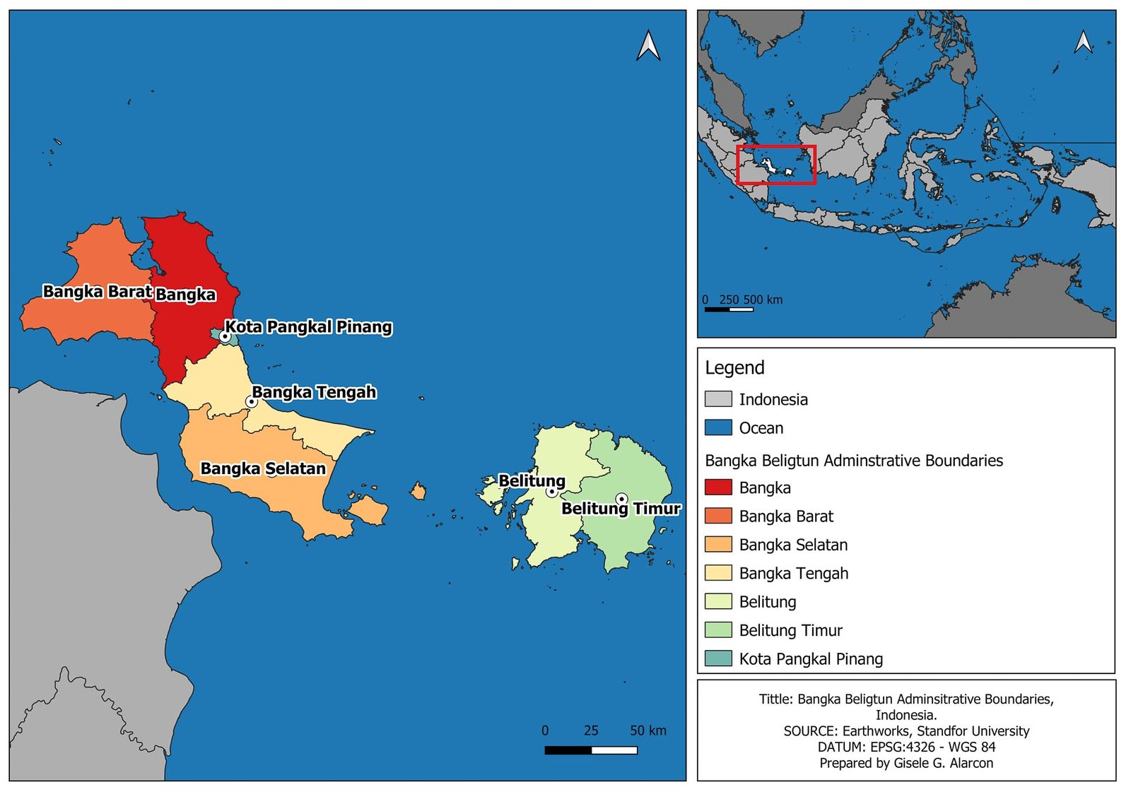
Provincial Government of Bangka Belitung Islands, Indonesia.
Although it is a home to plateau, valley, mountains, hills, and entirely surrounded by water, Bangka Belitung has an equatorial climate with a large cover of tropical rainforests and vegetation. The largest forest area in Bangka Belitung Province is in South Bangka Regency with a total of 136,626 hectares, consisting of 27,557 hectares of protected forest, 106,153 hectares of production forest, and 2,914 hectares of conservation forest. Production forest is focused on producing several types of forestry commodities, namely wood and its derivative products. Although the province has various kinds of quality wood that is traded outside the region, the rainforests are disappearing due to deforestation because of mining and agricultural operations.
As per 2023, the national government has issued 220 tin mining licenses with a total area of 511,361 hectares which is mostly located in Bangka Belitung Islands Province. The number accounts for a total onshore area of 327,524 hectares and offshore of 183,837 ha. PT Timah Tbk, the state-owned tin company, owns 127 out of those licenses with working areas mostly located in the province—its on-shore coverage is 288,716 ha and offshore 184,672 hectares. This number is significant to show that PT Timah Tbk is dominating the industrial-scale operation of tin mining and processing in the region which contributes to 90% of national tin production.
The most pressing environmental issues in the region derive from both formal and informal practices of tin mining. Following the Bangka Regency’s policy in 2001 which allowed people to mine tin, the traditional onshore tin mines have led not only to deforestation and but also to contaminated well water, while the offshore operations have been a threat to coral reefs and damaging fish breeding grounds. Among the most common problems is “kolong” or a water basin/pit area as an impact of post-tin mining activity. Unconventional mining around the kolong caused contamination of water by heavy metals from tailing. As per 2018, there were 12,607 kolong with a total area of 15,579 hectares. With an open-pit system, tin mining has led to detrimental effects to the biophysical aspects of land resources and the environment, including the deterioration of soil structure, changes in soil texture, loss of soil organic matter, and loss of soil fertility. The mining also results in the loss of a number of important biota that provide environmental services such as the provision of forest products, soil stability, maintaining the hydrological cycle, and carbon sequestration.


